Geography

·
New England
·
Midland or Middle Atlantic
·
South
·
Middle West or Midwest
·
West
|
US
area total
|
9,631,418
sq km
|
|
US land area (without water)
|
9,161,923
sq km
|
|
US population (July 2005 estimate)
|
295,734,134
|
|
lowest point
|
Death
Valley, Nevada -86 m
|
|
highest point
|
Mount
McKinley, Alaska 6,194 m
|
|
highest point in Continental US
|
Mount
Whitney, California 4,417 m
|
|
GDP (purchasing power parity, 2005 est.)
|
$12.37
trillion (written $12,370,000,000,000)
|
|
GDP per capita (purchasing power parity, 2005 est.)
|
$41,800
|
Dimensions
The United
States of America is one of the largest countries in the world. Its territory
is over 9 million sq kms, ranking 3rd overall after Russia and Canada,
while its population, approaching 300 million in 2005, is also the 3rd
largest after China and India. But the economy of the US is the most dominant
in the world: its Gross Domestic Product (GDP) exceeded $12 trillion in 2005
(that’s 12 zeros!), about 20% of the world’s total, while US population makes
up less than 5% of the estimated 6.5 billion people currently living on Earth.
As a result, the US is a very powerful and extremely rich country: the average
GDP per capita was $41,800 in 2005.
It may be
helpful to compare the US to Europe. The territory of the US is roughly
equal to the whole of Europe, including the Eastern
European part of Russia as far as the Ural Mountains. The total GDP
of the US is higher than
that of the entire European Union, but the population of the EU is
significantly higher: it was estimated over 460 million in 2005, more than 50%
above the US population
total. This obviously means that population density is significantly higher,
while GDP per capita is considerably lower in the EU than in the US (although one
always has to be careful with averages: there are huge differences in wealth
within the US just like
within the EU).
Political geography: the States
The huge
territory of the US is politically
divided into 50 states, each of them having an autonomous government with wide
powers in many areas of life, such as law, education, or trade. The 50 states form
a federal republic that is governed by the federal or the national government.
The national capital is
Washington,
D.C., the only US city that
belongs to none of the states: its territory, the District of
Columbia, is governed directly by the federal government.
Out of the 50
member states of the US, 48 states form
a contiguous territorial whole between the Atlantic and the Pacific
coast, which means you can travel from any one of them into any other overland,
without crossing into another country. These 48 states are called "the
Continental US"
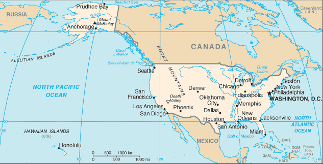 The remaining
two states –
Alaska and Hawaii – are separated
from the other states by huge distances. Alaska is in the arctic northwestern
corner of the North American continent, separated from the rest of the US by
Western Canada, while Hawaii is located in the tropical region of the Pacific
Ocean, about 2500 miles (4000 kms) southwest of the West Coast of the US. These
two states have their own special characteristics, both geographically and
culturally. Furthermore, the US governs a
number of small islands in the Caribbean Sea – the most
important one is
Puerto Rico –, and also in the Pacific Ocean.
The remaining
two states –
Alaska and Hawaii – are separated
from the other states by huge distances. Alaska is in the arctic northwestern
corner of the North American continent, separated from the rest of the US by
Western Canada, while Hawaii is located in the tropical region of the Pacific
Ocean, about 2500 miles (4000 kms) southwest of the West Coast of the US. These
two states have their own special characteristics, both geographically and
culturally. Furthermore, the US governs a
number of small islands in the Caribbean Sea – the most
important one is
Puerto Rico –, and also in the Pacific Ocean.
The size and the
distribution of the states have little connection to the physical geography of
the US: they were
established in different historical periods and under varied circumstances,
even though sometimes large rivers or mountain ranges were set as borders. In
general, the smallest states are on the northern
Atlantic
Coast, and their
average area gets larger as one goes westward and southward. The population
density shows the opposite tendency: whereas the northern Atlantic coast is
densely populated, further inland there are fewer big cities and the
countryside is emptier. Some of the largest states in the central lowland and
in the northern Rocky Mountains have a population well
below one million. The two exceptions are
California on the southern
Pacific coast and
Texas on the
Mexican
Gulf, which are
among the largest both by area and by population. But even within these states,
the great majority of the inhabitants is concentrated in the crowded big cities
and their suburbs, whereas the huge deserts and high mountains are practically
empty.
Surface and Rivers
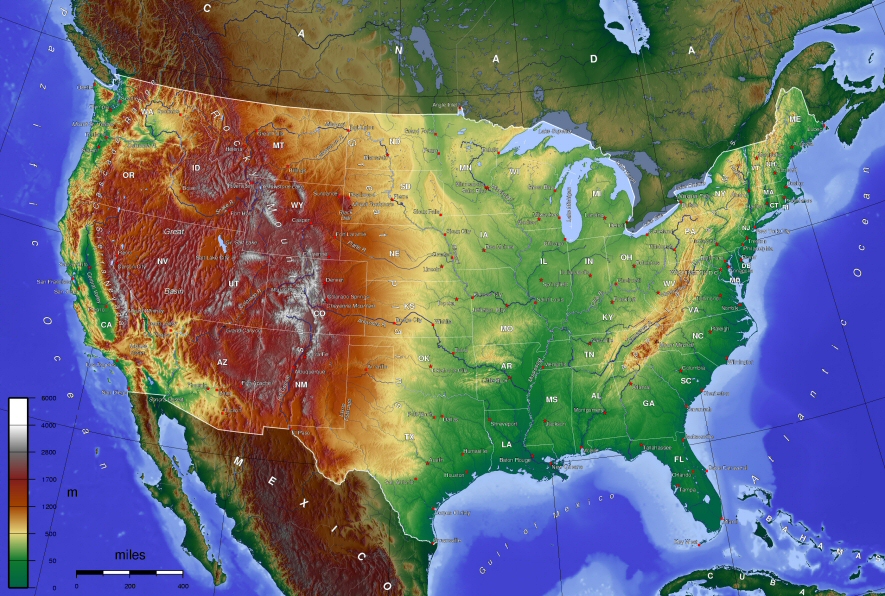
It is an
interesting aspect of the surface of the continental US that all the major
dividing lines are oriented in a north-south direction. There are three
mountain ranges: the
Appalachian Mountains along the East
Coast, the
Rocky Mountains in the central
western part of the continent, and a coastal mountain range along the West
Coast which has a variety of names (e.g. Cascades in the Northwest, Sierra
Nevada in
California). The four
major regions of the country are separated from one another by these mountains.
These are the following:
(1)
the coastal plain east of the Appalachians, along the Atlantic Coast; it is
very narrow up north but gets wider further south and continues westward along
the Gulf of Mexico until it merges with the central lowland.
(2)
the relatively low Appalachian Mountains, stretching in
a northeast-southwest direction from the eastern Canadian border to northern
Alabama and Georgia.
(3)
the
Interior Plains, or the central lowland between the Appalachians in the East and
the Rockies in the West, which is either totally flat or gently
undulates, and it is divided into two, roughly equal parts by the Mississippi
River.
(4)
the high mountains and deserts of the West from the Rockies to the coastal
range; a rugged and arid terrain consisting of valleys, basins, plateaus,
mesas, and canyons, characterized mostly by a desert climate and vegetation.
The largest
water systems of North America are the
Mississippi-Missouri and the Great Lakes-St. Lawrence systems. The
Mississippi rises in the
northern Plains and flows straight south until it reaches the Gulf of Mexico near
New Orleans. Its longest
tributary is the
Missouri, which rises in
the northern Rockies and continues in a general
east-southeast direction until it flows into the Mississippi at
St. Louis. The largest
left-bank tributary of the Mississippi is the
Ohio River, which comes
down from the northern Appalachians in a
southwestern direction, and unites with the
Tennessee River just before
flowing into the Mississippi. All taken
together, the Mississippi and its
tributaries drain about one-third of the territory of the US, and they have
functioned during history as major waterways for travel, trade and discovery.
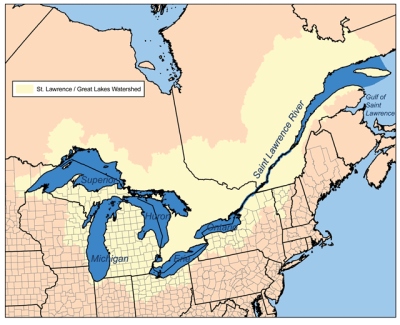 |
|
The Great Lakes and St. Lawrence river |
The five
Great
Lakes – Lake Superior, Lake Huron, Lake Michigan, Lake Eire and Lake
Ontario – are all interconnected by short rivers and waterfalls (the most
famous among them is
Niagara Falls flowing from the Eire into the
Ontario), and their excess water is drained into the Atlantic Ocean by the
St.
Lawrence River. The Lakes and the St. Lawrence form a natural border
between the US and Canada, except for Lake Michigan, which is fully
within the territory of the US.
Besides these
two large systems, there are a few other major waterways, such as the
Colorado
River, flowing southwest from the southern Rockies across the arid
Southwest, supplying most of the water for
Utah,
Arizona,
Nevada and Southern
California; and the
Rio Grande, which flows southeast from the same area
and forms part of the border between the US and Mexico. Along the coastal plain
in the east and the southeast, there are a number of short rivers carrying a
lot of water. Perhaps the most famous of them is the
Hudson, which flows
into the Atlantic at New York City.
Climate
The climate of
the main regions is determined by latitude (how far north that region is
situated), terrain (mountains, hills, basins, etc.) and distance from the sea.
On the basis of these, geographers distinguish eight main climatic regions
within the US. The variety of
climate within the US is even greater than within Europe: there is the humid
continental, with great extremes of temperature in winter and summer (most of
the flat inland areas west of the Appalachians), the hot and humid subtropical
(the southeastern coastal plain from the Carolinas to East
Texas), the mild and
rainy marine (the Pacific coast from San Francisco northward), the sunny and
dry mediterranean (the coastal area of Central and Southern
California), the
dry and arid desert (the Southwest between the Sierra Nevada and the Rockies),
the cool highland (the Rockies from
Colorado to
Montana), the cold arctic (in
Alaska), and the tropical (in Hawaii).
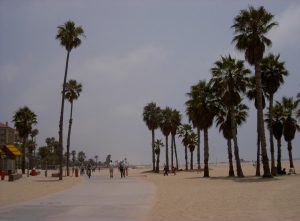
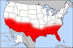
Los Angeles beach |
In a more
simplified way, the continental US is often divided into a Frost Belt and a Sun
Belt. The latter roughly equals
the southern part of the US from
California to the Carolinas, which tends to
be hotter all year, and especially the coastal areas have fewer weather
extremes than the inland areas (cooler summers, milder winters, more rain).
While traditionally the Frost Belt, especially the East Coast and the Great Lakes area, used to
have the majority of US population,
since World War II businesses and people have migrated to the Sun Belt in large
numbers (especially
California,
Florida, and
Texas).
For a European,
it is interesting to note that most of the territory of the US lies further
south than most of Europe: such northern cities as Chicago and New York are on
the same latitude as Rome and Naples, respectively, while a southern city like
New Orleans is as far south as Cairo!
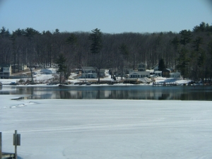
Winter in New Hampshire |
The latitude of
Budapest roughly matches
that of Seattle, the
northernmost large city of the US. This fact is
more noticeable during summers which tend to be rather hot and humid even in
the northern regions, while winters over much of the US can be rather
severe, with cold temperatures and occasional big snowfalls. The most
characteristic difference compared to the climate of Europe is the stronger
tendency of US weather toward
extremes: sudden changes in temperature, heatwaves, floodrains, thunderstorms
or snowfalls in unexpected seasons are not uncommon, while tornadoes or
hurricanes can bring huge destruction. The main reason for these extreme
changes is the openness of the North American continent to air masses both from
the north and the south (there are no mountain ranges running east-west), and
the lack of warm ocean currents (like the way the Gulf Stream tempers the
climate of Western Europe).
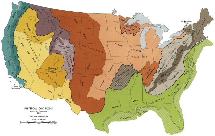
Cultural Regions
Cultural regions
are distinct from the physiographic regions described above. Whereas the
physiographic regions are distinguished by landforms, watersheds, climate,
soil, vegetation, and similar features, cultural regions have been shaped by
their different history, the settlement patterns, the economic features, the
degree of urbanization, the ethnic origin of the inhabitants, and other
features. In short, the cultural regions of the US are different
because the activities of humans have modified their different natural features
in a variety of ways.
Cultural regions
are more difficult to define and outline on a map than physiographic regions,
because there are often as many similarities between neighboring areas as there
are differences, so distinction between two regions is always relative. Thus the
continental US may be divided into regions in several ways: some scholars
distinguish four main regions; others five, eight or even ten. For example,
Virginia and
Louisiana are both
considered Southern states, still there are several features that distinguish
them from each other and also, one could discern several smaller regions within
each state. There is also disagreement about the boundaries of each region,
which do not necessarily coincide with state borders. In the following, the
regional division of one of the most famous American cultural geographers,
Wilbur Zelinsky, will be followed, who distinguished 5 principal culture areas
within the US:
(1) New England
(2) the Midland or Middle
Atlantic
(3) the South
(4) the Middle
Westor Midwest and
(5) the West.
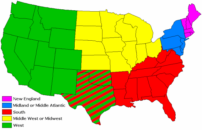
Other widespread
approaches combine New England and the Middle Atlantic
into a larger region called Northwest, or subdivide
the Midwest and the West into several smaller regions. All these
approaches have their use and validity, and in the description of each region,
the existence of distinct subregions will be noted.
New England
New England is the smallest
cultural region of the present US: it occupies the northeastern corner of the
country, and consists of the states of
Massachusetts,
Connecticut,
Rhode Island (the smallest
state of the US by territory),
New Hampshire,
Vermont, and
Maine. It is bordered
by
New York state on the
west, Canada on the north,
and the Atlantic Ocean on the south and east. It
has a long and rugged coastline, with many good natural harbours, while the
inland areas are mostly hilly, originally covered with dense forests. There are
few big cities in the region, except for Boston, capital of
Massachusetts, and the
historical, commercial and cultural centre of the whole region.
New England is one of the
oldest regions of the country. Its origins go back to the arrival of the first
Puritan settlers, the so-called
Pilgrims, aboard the
ship
Mayflowerat the coast of today’s
Massachusetts in 1620. The
great majority of people who settled this area were English Protestants, whose
Calvinist version of Protestantism was suppressed and persecuted by the
Anglican government of England. Therefore they
left England for the
American colonies to practice their religion freely. The name of the region
reflects the fact that this area remained for a long time ethnically
homogeneous and culturally similar to England, but it also
expressed the hope of the early settlers that they would be able to create a
new, better version of their homeland in the New World.
The character of
New England has been shaped by the Puritans: they settled in
small, self-governing communities, in which town leaders and church elders were
elected and public issues were discussed and decided at town meetings. Although
originally they did not tolerate other religious groups, by the late 18th
century democratic rights were extended to most residents. The spirit of
religious devotion, democracy and the strong sense of community are often
considered Puritan legacy in American culture.
Since the
climate of the region is rather cold and the soil is rocky and poor,
self-sufficient farms were not prosperous, and New Englanders soon began to take
up shipbuilding, manufacturing, and trade. By the time of the American
Revolution, they earned the nickname
Yankee, a word of
uncertain origin that was associated with hard work, thrift, ingenuity, a good
business sense and occasionally craftiness. The Yankee peddler and storekeper
became popular folklore figures in colonial America, and Yankee
values came to be epitomized by the Boston-born
Benjamin Franklin, the famous printer,
publisher, inventor, and politician, who in his Autobiography emphasized the values of industry and frugality as
the way to his fame and fortune.
New England and
particularly Boston played a very
important part in the
American Revolution, since local
merchants resented British taxes and limitations on colonial trade very
strongly. The
Boston Tea Party in 1773 triggered the armed conflict between Britain and the
colonies, and the first shots were also fired outside Boston in 1775. New
Englander
John Adamsbecame the 2nd President of the US in 1796.
In the early 19th
century, New England became the first region to
industrialize, and Boston developed into
a national commercial and financial center, attracting many immigrants,
especially Irish and later, Italians. New England has always been
the educational center of the nation, because the Puritans put a strong
emphasis on schooling: they wanted all people to be able to read the Bible, and
expected ministers to be well-educated. As a result, the oldest and most
prestigious universities were founded here, including
Harvard ( ), in 1636, and
Yale (), in 1701. This
region produced many of the most famous writers and intellectuals of the 19th
century, including
Nathaniel Hawthorne,
who wrote several stories on the life of early Puritan settlers, or the
philosopher-essayists
Ralph Waldo
Emerson and
Henry David Thoreau.
The strong religious values of New Englanders expressed themselves in support
for social reforms such as the temperance movement against alcoholic drinks, or
the abolition of slavery, first championed by
William Lloyd Garrison.
), in 1636, and
Yale (), in 1701. This
region produced many of the most famous writers and intellectuals of the 19th
century, including
Nathaniel Hawthorne,
who wrote several stories on the life of early Puritan settlers, or the
philosopher-essayists
Ralph Waldo
Emerson and
Henry David Thoreau.
The strong religious values of New Englanders expressed themselves in support
for social reforms such as the temperance movement against alcoholic drinks, or
the abolition of slavery, first championed by
William Lloyd Garrison.
During the 20th
century, New England gradually lost its earlier
pre-eminence in business and politics, but remained influential due to its
excellent education and vibrant cultural life. Many of the country’s recent
leaders have been educated at one of the elite universities of New England, and
Massachusetts-born John F. Kennedy became the first Catholic President of the US in 1960.
Midland or Middle
Atlantic
This region, as
the name suggests, is between two very different regions, New England and the South.
Out of these, it shares more cultural similarities with New England, but it is set apart
by its different social and political history. It consists of the states of
New York,
Pennsylvania,
New Jersey,
Delaware, and
Maryland. It is bordered
by Lake Eire, Ontario, the St. Lawrence
River and Canada on the north, New England on the
northeast, the Atlantic Ocean on the east, the
Midwestern state of Ohio on the west and
the Southern states of
Virginia and
West Virginia on the south.
Unlike New England, the Middle
Atlantic area was never homogeneous in nationality or religion: in fact, some
of the first settlers of this region did not come from England.
New York City, on the mouth
of the Hudson River was founded by the Dutch
under the name New Amsterdam; the first
settlements along the
Delaware River were
established by Swedes.
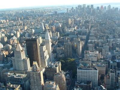
Broadway as seen from the Empire State
Building |
Pennsylvania was founded by
a wealthy English
Quaker,
William Penn, but much of it
was settled by Protestant German groups seeking religious freedom. As a result,
the Midland region became far more varied than either New England or the South:
it has always had a great variety of ethnic groups, religions and economic
activities. The two largest cities of the region, New York and
Philadelphia, became
prosperous as the largest ports as well as business and commercial centers of
the English colonies by the late 18th century. Therefore, they have
attracted huge numbers of foreign immigrants all through their history.
Territories further west, however, remained rural and agricultural (like
upstate
New York or eastern
Pennsylvania), while other
areas like western
Pennsylvania or
New Jersey became heavily
industrialized during the 19th century: Pittsburgh, for example,
became the center of the American iron and steel industry, drawing on nearby
coal mines.
By the late 20th
century, the coastal part of the Middle Atlantic states became the most densely
populated region in the whole United States: there is practically a continuous
string of cities and suburbsall the way from the
Virginian suburbs of
Washington D.C. (located between
Maryland and
Virginia) up to New York City and
beyond to the northern suburbs of Boston, including such cities as Baltimore
(Maryland) and Philadelphia. In the continuous process or urbanization, which involved migration
from all other parts of the United States, individual differences between
cities and regions have become relatively small and insignificant: some authors
prefer to consider New England and the Middle Atlantic together as one single,
heavily urbanized region under such names as the Northeast, the East Coast, or Megalopolis. Nevertheless, differences
in history and immigration still justify the separation of this larger area
into two regions.
New Yorkis the largest city not only of the region,
but the whole US, with more than 7 million people living within its 5 boroughs
(Manhattan, Brooklyn, Queens, the Bronx, and Staten Island), and some 20
million in the larger metropolitan areaaround the city. It is perhaps the biggest
center of world finance and business: the name of
Wall Street, where the New
York Stock Exchange is, stands for American finance in general. It is also an
American capital of culture, home of the largest publisher firms, the most
prestigious theaters (one of the oldest streets in Manhattan,
Broadway,
became a synonym for American theater), several world-famous museums,
Columbia
University, and the
headquarters of national radio and television networks. The
island of
Manhattan, the oldest and
central part of New York, is among the
most famous places in the world: its huge skyscrapers and the large Central Park tucked in among
them, are easily recognizable for most people in in the world. It is a city of
extraordinary diversity, the largest mixture of immigrants and migrants in the
country. It is also a city of extremes: elegant and expensive hotels, apartment
houses, restaurants and shops coexist with huge slums, abandoned buildings, lots
of homeless people and drug addicts.
New York
State has given many
famous people to the US, including one
of the greatest political dynasties, the Roosevelts, whose origins
go back to colonial Dutch settlers. Two members of the family,
Theodore Roosevelt (1901–09) and
Franklin Delano Roosevelt (1933–45)
became presidents. Famous writers from the region include two 19th-century
classics,
Washington Irving and
James Fenimore Cooper (whose
Leatherstocking tales take place in upstate New York). Out of 20th
century authors,
Bernard Malamud, one of the greatest Jewish-American writers, lived and wrote in
Brooklyn, where many of his stories take place; contemporary novelist
Paul Auster is famous for his
New York Trilogy. Another famous artist closely associated with
New York is writer and film director
Woody Allen, whose movies
successfully capture the unique spirit of the "Big Apple".
South
The South is
perhaps the most distinctive region of the US. Its name is
misleading: it is not the southern but only the southeastern part of the US, stretching
from
Virginia on the East
Coast to Florida in the south
and
Texas in the west.
Its identity comes from its history: it includes those states that maintained
slavery as a legal institution and established their economic and social life
on it. As a result, the South came into conflict with the North in the first
half of the 19th century, and this conflict led to the outbreak of
the
Civil War (1861–65). The defeat
of the South in the war resulted in a long period of economic depression,
social problems and long-standing hostility towards the rest of the US, which
increased the difference of Southern culture even more. The South only began to
reintegrate into the US in the second
half of the 20th century.
Its boundaries
are not always easy to define: there were 15 slave-owning states in 1861, but only 12 of
them are considered by geographers part of the modern South:
Maryland in the
northeast, and
Missouri in the northwest do not share most cultural features
with the South today, while the western part of
Texas had not yet been settled
by whites at the time of the Civil War, therefore the inclusion of
Texas as a
whole is doubtful. That leaves
Virginia,
West Virginia,
Kentucky,
Tennessee, North and
South Carolina, Georgia,
Florida,
Alabama,
Mississippi,
Louisiana and
Arkansas in the South.
The most widely accepted boundaries of the South are the following: it is
bordered by the Atlantic Ocean on the east, the Gulf of Mexico on the south,
the Middle Atlantic states of
Pennsylvania and
Maryland on the
northeast, and the Ohio River on the north, separating
it from the eastern Middle West. West of the
Mississippi,
Louisiana, Arkansas and the eastern
part of
Texas (roughly the
territory east of the Dallas–Houston line) belong to the South.
Such a huge
region obviously has certain differences as well as a general similarity. The
oldest part of the region is the
Chesapeake
Bay area, primarily the coastal part of
Virginia, where the
first English settlers arrived in 1607 and founded the city of
Jamestown. The hot, subtropical
climate and the good soil made the area very attractive for farming, and plantation

cotton plant |
agriculture quickly developed. Plantations
were large plots of land cultivated by many servants and later slaves,
producing one single kind of crop to be sold for cash. The earliest cash crops
were tobacco, rice and sugar cane, but in the early 19th century,
cotton became the most popular plant in the South. Wealthy Virginia planters
George Washington,
Thomas Jefferson, and
James Madison
played a crucial role in the American Revolution, and subsequently all became
presidents. Another famous president of the young nation,
Andrew Jackson (1829–37), was a self-made planter.
As the frontierof white settlement moved westward in the
early 19th century, cotton plantations spread with it. This part of
the South, the fertile coastal plain along the Gulf of Mexico from
South Carolina to
Louisiana, came to be called the
Deep Southor the Lowland
South. The majority
of the black population of the US is still
concentrated in the Deep South. Further north, in the
southern part of the Appalachians, the soil was poorer
and the climate cooler, thus it was not suitable for plantations. In this area,
small family farms were established producing grain and dairy, raising
livestock, using few or no slaves. This area, ranging from
West Virginia to
Kentucky,
Tennessee and
Arkansas, is called the Upland South. They had
little economic interest in the maintenance of slavery, and some of these
states refused to fight against the North in the Civil War.
All parts of the
South, however, share certain characteristic traits. The predominant way of
life was agricultural and rural, and few large towns developed over this
enormous area. The urban centers of the South are all centers of commerce,
where the agricultural products could be sold and shipped abroad: New Orleans
on the mouth of the
Mississippi,
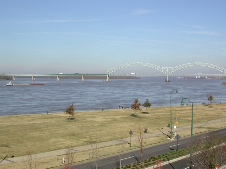
The Mississippi river at Memphis, TN |
Memphis further up the river in western
Tennessee, or Atlanta in Georgia are typical examples. The lack of big cities
did not attract many foreign immigrants, and therefore the white population
remained native-born and mostly British in origin, except for the old French
settlers in
Louisiana and some
Spanish in Florida. After the
Civil War, economic depression kept immigrants out of the region, so the South
changed little in population or lifestyle while the rest of the US underwent a
thorough transformation.
All these
factors created the most conservative region of the United States. Most
Southerners distrusted and disliked other Americans, and whites held a grudge
against “the
Yankees” (the
word means non-Southerner Americans in the South), who defeated and humiliated
them in the Civil War. Most of them felt nostalgic about the “Old South” before
1860, when the region was rich and successful; this nostalgic image was
popularized by the hugely successful novel of
Margaret Mitchell, Gone with
the Wind (1936), turned into a spectacular movie in 1939. Most whites were
reluctant to admit that slavery was wrong, claiming that owners treated their
slaves with parental care. Although black slaves had to be given their freedom,
strict
segregation between
whites and blacks was the law in Southern states until the 1960s, and ethnic
tensions are still present in many areas. The South is the most religious
region, where the majority belong to conservative Protestant denominations,
especially the
Southern Baptists:
the region is often nicknamed the
Bible
Belt
the Bible Belt |
because of its high proportion of churchgoers.
Martin Luther King, Jr., the
famous leader of the black
civil
rights movement in the 1950s and 60s, was also a Baptist minister. The
majority of the white population of the South has recently been supporting the
more conservative
Republican Party.
Since World War
II, the South has changed considerably: many businesses began to move to the
South, attracted by low labor costs and low taxes, while people were looking
for a more pleasant climate in the “Sun
Belt”, especially
Texas, Florida and Georgia. As a result, some areas of
the South have undergone industrialization and urbanization, and the population
has become more mixed. Nevertheless, other areas preserved many of the
traditional Southern characteristics.
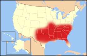
the Sun Belt |
Texas and
Florida differ significantly
from the rest of the Southern states. Florida has always been
special, because it belonged to Spain until 1819, and
its poor, swampy land was unattractive for agriculture, so it remained sparsely
populated and was little affected by slavery. It began to develop spectacularly
in the 20th century, when its pleasant climate and sandy beaches
were discovered for tourism. Today, Florida has the fourth
largest population in the US, and is still
growing fast. The state is still among the favourite destinations of retired
people from the north, while it also has a significant Cuban minority in and
around Miami, who mostly fled from
Fidel Castro’s Communist regime
in the early 1960s.
%20small.jpg)
Texas Longhorn cattle |
Texas occupies a special place in
the history of the US as the only member state which was for a short while an
independent republic, after it seceded from Mexico in 1836. When the US finally annexed
Texas in 1845, border
disputes provoked a war with Mexico, resulting in the
US occupation of
most of the present Southwest.
Texas is the largest
state in the Continental US, and has the second largest population, which
underlies the famous pride and confidence – some might say arrogance – of
Texans.
Texas became a very
rich state in the early 20th century, when the largest oil reserves
of the US were discovered
here. Although East
Texas is
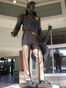
Statue of Elvis in Memphis, TN |
usually considered part
of the South, West
Texas has more cultural
similarities with the neighbouring state of
New Mexico and the
Southwest, so the whole state might be considered a transitional zone between
two regions.
The South is
very proud of its rich cultural heritage. During the 20th century,
several Southern authors achieved international fame, e.g.
William Faulkner, most of whose novels take place in an imaginary
Southern county, or
Tennessee Williams,
whose most successful plays portray the decline of Southern families. Most of
the popular American musical genres originate from the region:
blues was the music of black slaves in
the Mississippi delta,
gospel music developed in black church
congregations, while white
country music
has its roots in English and Scottish folk music played in the Appalachian
hills.
Jazz developed out of the
black heritage in New Orleans in the early 20th
century, while
rock & roll used
elements of both blues and country in the 1950s. Dozens of world-famous
American musicians came from the South, including jazz trumpeter and singer
Louis Armstrong, born in
New Orleans, the “King of
rock & roll”,
Elvis Presley, who
grew up in Memphis, or country
singer
Johnny Cash, born in
Arkansas.
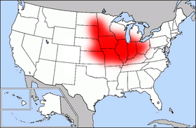
Middle West or
Midwest
The Middle West, or Midwest, as most people
call it, is considered the American heartland: it is right in the middle of the
North American continent, occupying the productive soils of the Interior
Plains. It has no access to any ocean, and most of its territory consists of
either completely flat land or gently rolling prairies. It is roughly
triangular in shape, with the narrowest part in the east, between the Great Lakes and the Ohio River that separates
the Midwest from the South. West of the Mississippi River it
extends as far as the Canadian border in the north, and it ends in the west
roughly along the 100th Meridian (a little east of the Rockies),
where the climate becomes too dry to support Midwestern agriculture. The southern
boundary is the least clearly defined, because no clear geographic border
separates the Midwest from the South west of the
Mississippi. The most
widely accepted opinion draws the line at the southern border of
Missouri and
Kansas, but on the
basis of geographic features,
Oklahoma and North
Texas should also
belong here (although they are more commonly associated with the Southwest).
Altogether, there are 12 Midwestern states: Ohio,
Indiana,
Illinois,
Michigan and
Wisconsin east of the
Mississippi, and
Minnesota,
Iowa,
Missouri,
North Dakota,
South Dakota,
Nebraska and
Kansas west of the
river.
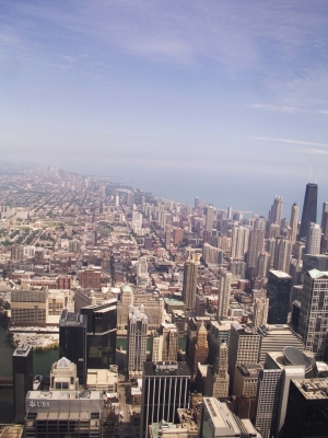
View of Chicago from the top of Sears Tower |
Within the
region, the most important dividing line is the Mississippi: the land west
of it was settled later, in the second half of the 19th century, than
the Great Lakes areaand the valley of the Ohio River. Also, much of
the eastern Midwest was transformed by
industrialization in the late 19th and early 20th
centuries: heavy industry began a spectacular development in the Great Lakes area, giving
rise to several big cities like Cleveland in
Ohio or
Detroit in
Michigan, the center of
American car manufacturing. Further west, Chicago emerged as the
largest city of the whole region, because it was in the center of western
railway lines, and developed a huge meat-packing and food-processing industry.
Today the Chicago metropolitan
area is the third largest in the whole nation, with close to 9 million inhabitants
in 2000. As a result of the industrial development, the eastern Midwest has lost many
of the typical characteristics of the region.
the Corn Belt |
In general, the
states west of the Mississippi remained rural
and agricultural, with no big cities except for St. Louis and
Kansas City, both on the Missouri River, which grew
large as centers of commerce and the starting point of immigrants planning to
move westward. The common joke says that the Midwest has nothing but
“cows and corn,” referring the two most common products of the local farms.
Three-fourth of US corn is grown
in the so-called
Corn Belt, which
stretches in an east-west direction from
Indiana to eastern
Nebraska. Further north,
especially in
Minnesota and
Wisconsin, where the
summer climate is too cool for corn, cattle raising and dairy farming are the
most common branches of agriculture. The climate of the region is getting drier
as one travels westward, therefore on the western edge of the region (Kansas and the Dakotas), the primary
crop is wheat, and irrigation is necessary.
In the American
popular imagination, the Midwest is seen as the most
characteristically American region, where the traditional values of the nation
have been preserved. Farmers worked hard, had an independent livelihood and
treated all other people as equals. These are the principles on which the United States was founded,
and before the 20th century, farm and small town life were both
considered morally superior to the corrupting influence of the big cities.
Although today the great majority of the US lives in big cities or their
suburbs, the ideal of a slow, peaceful and healthy rural lifestyle still has a
very positive image for many Americans.
In the large
industrial cities, the extraordinary mixture of various immigrant ethnic groups
created a typically American blend of cultures and traditions.
Perhaps the most
famous author who immortalized life in a small Midwestern town was
Mark Twain, who grew up in the mid-19th
century in Hannibal,
Missouri, a small town
on the Mississippi River. Famous Midwesterners include
Abraham Lincoln, who was an
Illinois
Congressman before elected President, or 20th century presidents
Harry Truman (1945–53) from
Missouri and
Dwight D. Eisenhower (1953–61), who
grew up in
Kansas. The industrial
part of the Midwest has such heroes as
Thomas
A. Edison, inventor of the light bulb and the phonograph, born in Ohio;
John D. Rockefeller, founder of
Standard Oil Co. in Cleveland, for a while the largest company in the world; or
Henry Ford, who revolutionized car
manufacturing in Detroit.
West
The West
occupies an enormous area, almost half of the Continental United States, from
the Rocky Mountains to the Pacific
Coast. It is the
youngest cultural region of the country, since it was the “last frontier,” the last region within the present US to be settled
by white European immigrants. In the mid-19th century, the western
half of the present US was still mostly wilderness inhabited by Native American
tribes, and even at the turn of the 20th century population was
scattered and small beyond the Pacific coastal area – with the significant
exception of
New Mexico, where Spanish settlers moved in as early as the 17th century,
and Santa Fé, founded in 1610, is the oldest city in the US west of the
Mississippi.
With such a
short history behind it, the unity of the West as a region is seriously debated
by many scholars, since there are very few geographical or cultural features
that seem to unite the crowded cities of
California with the empty
deserts of Nevada or the high
mountains of Colorado. Many prefer to
subdivide the area into smaller regions on the basis of landforms, economic
activities or the patterns of urbanization.

Rocky Mountains |
Yet
there are certain unifying features to the region as a whole: while it is
extremely rich in impressive landscape and beautiful natural sights, it has
little water and fertile land, covered mostly by tall mountain ranges and vast
desert plains. As a result, it can support few people, and with the exception of
California, this region
has the lowest population density in the US. This
relatively small population is concentrated in a handful of metropolitan areas, primarily along the
Pacific Coast and some other
places with good water supply. The rest of the country is almost empty, with a
few scattered small towns and farms. This is even true of
California, which is
sharply divided into an extremely crowded coastal area and a thinly populated
backland beyond the coastal mountains. The West has preserved much of the
landscape and the atmosphere of the Western tales and movies that became so
strongly associated with the image of the US abroad.
On the basis of
terrain and climate, the Western
states can be subdivided into the Mountain West,
the Desert
Westand the West Coast.
The Mountain Westincludes the states of
Idaho,
Montana,
Wyoming
and Colorado, crossed by the highest ranges of the Rocky Mountains (although
the eastern part of the last three states is relatively flat, and geographically
belongs to the Interior Plains). The Desert West
covers the largest
%20small.jpg)
Monument Valley |
part of the region, most
of the land between the Rockies and the coastal range,
which receive very little rain or snow, therefore human life is possible only
near rivers or lakes in the states of
Nevada,
Utah,
Arizona,
New Mexico, and Eastern
California. The West Coast
is shared by
California,
Oregon, and
Washington. The
coastal areas of the two northwestern states as well as Northern
California have a cool,
rainy and mild climate under the influence of the ocean. But
the term West
Coast is understood by
most Americans to
mean
the coastal area
of Southern
California, with its warm
sunshine, sandy beaches, and laid-back lifestyle.
Another
subregional division considers cultural differences rather than climate. On that
basis, the area along the Mexican border –
Southern
California,
Arizona,
New Mexico, as well as West
and South
Texas – is often referred
to as the Southwest, a region
distinguished not so much by geography but by a heavy influence of Hispanic
culture which derives from the large and continuing flow of Mexican immigrants
across the border. The state of Utah differs from
the rest of the region by the presence of the
Mormon church, the first settlers of the Great Salt Lake area in 1847,
whose hard work and strong community spirit turned the desert into prosperous
farmland and a thriving business area.

Las Vegas |
Apart from the
river valleys, the West has little fertile agricultural land: the predominant
economic activities before the 20th century were cattle raising in
large open ranges and mining various ores, especially precious metals. Many of
the earliest white settlers were attracted to areas of the West by tales of
fabulous riches of gold and silver in the distant mountains of northern
California,
Colorado or
Montana. Other
settlements sprang up along railroad lines, functioning as local centers of
trade and communication. After World War II, a few cities began to attract
businesses and people from other regions, and quickly developed into large
population centers, such as Denver in
Colorado,
Salt Lake City in
Utah,
Las Vegas in
Nevada,
Phoenix in
Arizona or
Seattle in
Washington. Today, the
majority of the population of these states is concentrated in and around these
cities, and they continue to experience quick growth as part of the general
migration into the “Sun Belt.”
California was the first
state to be founded in the West, shortly after the famous gold rush in 1849
attracted people from the east to the San Francisco area in the
northern part of the state. Later settlers began to cultivate the fertile Central Valley between the
coastal range and the Sierra Nevada, turning
California into the
primary producer of various fruits and vegetables, orange, grape and wine in
the US. The
attractions of Southern
California were discovered
in the late 19th century, and
Hollywoodsoon achieved worldwide fame as the center of
the American motion-picture and entertainment industry. Millions of people from
other parts of the US and all over
the world have been attracted by the permanent sunshine, the sandy beaches, and
the career opportunities to the Los Angeles area, turning
it into the second largest metropolitan area in the country, with more than 16
million people. Since the 1960s,
California has been the
state with the largest population in the US, with an
estimated 36 million people in 2005. This population is also among the most
mixed in the US, with the
largest groups of Asian immigrants in the US.
The West evokes a variety of
cultural associations in Americans. The strongest and most enduring images were
popularized by Western movies: spectacular landscapes, mountain or desert
vistas, small and dusty towns, wild Indians, dangerous outlaws, lonely cowboys
driving cattle across the prairie. Out of these, only the impressive but tough
natural environment remains. Cattle ranchers and farmers drive around in pick-up
trucks, huge modern cities grew out of the desert, and public safety is probably
a lot worse in inner-city Los Angeles than in the "Wild West". Another set of
associations are connected to California and the West Coast. The area has
attracted Americans and immigrants since the mid-19th century with its promise
of unlimited opportunities and a new life without the restrictions of the old
environment. Californians are thought to be laid-back, free from inhibitions,
ready to try new and unusual things, prone to eccentric ideas. On top of
all, Hollywood is still a magnet for hundreds of thousands of people who dream
of making a career in the movie business.
Famous people of the West
include writer
Jack London, a native of San Francisco, whose stories of
the Alaska Gold Rush (in which he also took part) made him world famous.
John
Steinbeck was another Californian author of international fame, whose most
famous novel, Grapes of Wrath (1939), tells the story of poor Oklahoma
farmers forced to move to California during the Great Depression. Two famous
20th century presidents are associated with California:
Richard Nixon
(1969-1974) was born and raised in the state, and he entered national politics
as a Representative of a California district; while
Ronald Reagan
(1981-89), although he grew up in the Midwest, started his political career as
governor of California. Contemporary heroes of the West include
Bill Gates,
owner of Microsoft Corporation and one of the richest people in the world, who
is a native of Seattle, Washington state, and Microsoft's headquarters is still
located near the city. Another, very different kind of cultural icon also
came from Seattle:
Kurt Cobain, leader of the grunge band Nirvana, whose
musical style and brooding lyrics initiated a small revolution in American rock
music. Cobain committed suicide in 1994.
Geographic Facts and Data
The
largest states by land area:
|
1.
|
Alaska
|
571,951 sq miles = 1,481,347 sq km
|
|
2.
|
Texas
|
261,797 sq miles = 678,051 sq km
|
|
3.
|
California
|
155,959 sq miles = 403,933 sq km
|
|
4.
|
Montana
|
145,552 sq miles = 376,979 sq km
|
|
5.
|
New Mexico
|
121,356 sq miles = 314,309 sq km
|
|
6.
|
Arizona
|
113,635 sq miles = 294,312 sq km
|
|
7.
|
Nevada
|
109,826 sq miles = 284,448 sq km
|
|
8.
|
Colorado
|
103,718 sq miles = 268,627 sq km
|
|
9.
|
Wyoming
|
97,100 sq miles = 251,489 sq km
|
|
10.
|
Oregon
|
95, 997 sq miles = 248,631 sq km
|
The
largest states by population (July 2005 estimates):
|
1.
|
California
|
36,132,147
|
|
2.
|
Texas
|
22,859,968
|
|
3.
|
New York
|
19,254,630
|
|
4.
|
Florida
|
17,789,864
|
|
5.
|
Illinois
|
12,763,371
|
|
6.
|
Pennsylvania
|
12,429,616
|
|
7.
|
Ohio
|
11,464,042
|
|
8.
|
Michigan
|
10,120,860
|
|
9.
|
Georgia
|
9,072,576
|
|
10.
|
New Jersey
|
8,717,925
|
The
smallest states by land area:
|
50.
|
Rhode Island
|
1,045
sq miles = 2,706 sq km
|
|
49.
|
Delaware
|
1,954
sq miles = 5,060 sq km
|
|
48.
|
Connecticut
|
4,845
sq miles = 12,548 sq km
|
|
47.
|
Hawaii
|
6,423
sq miles = 16,635 sq km
|
|
46.
|
New Jersey
|
7,417
sq miles = 19,211 sq km
|
The
smallest states by population:
The
largest cities (1999 estimates, rounded figures):
|
1.
|
New York
|
|
|
2.
|
Los Angeles
|
3.6
million
|
|
3.
|
Chicago
|
2.8
million
|
|
4.
|
Houston
|
1.9
million
|
|
5.
|
Philadelphia
|
1.4
million
|
|
6.
|
San Diego
|
1.2
million
|
|
7.
|
Phoenix
|
1.2
million
|
|
8.
|
San Antonio
|
1.1
million
|
|
9.
|
Dallas
|
1.1
million
|
|
10.
|
Detroit
|
1 million
|
The largest
metropolitan areas (1999 estimates, rounded figures):
|
1.
|
New York–Long Island–Northern
New Jersey
|
20.2
million
|
|
2.
|
Los Angeles–Orange County
|
16
million
|
|
3.
|
Chicago–Gary
|
8.9 million
|
|
4.
|
Washington–Baltimore
|
7.4 million
|
|
5.
|
San Francisco–Oakland–San Jose
|
6.9 million
|
|
6.
|
Philadelphia–Atlantic City
|
6 million
|
|
7.
|
Boston–Worcester
|
5.7 million
|
|
8.
|
Detroit–Ann Arbor
|
5.5 million
|
|
9.
|
Dallas–Fort Worth
|
4.9 million
|
|
10.
|
Houston–Galveston
|
4.5 million
|
Alabama,
Alaska,
Arizona,
Arkansas,
California,
Colorado,
Connecticut,
Delaware,
Florida,
Georgia,
Hawaii,
Idaho,
Illinois,
Indiana,
Iowa,
Kansas,
Kentucky,
Louisiana,
Maine,
Maryland,
Massachusetts,
Michigan,
Minnesota,
Mississippi,
Missouri,
Montana,
Nebraska,
Nevada,
New Hampshire,
New Jersey,
New Mexico,
New York,
North
Carolina,
North Dakota,
Ohio,
Oklahoma,
Oregon,
Pennsylvania,
Rhode Island,
South Carolina,
South Dakota,
Tennessee,
Texas,
Utah,
Vermont,
Virginia,
Washington,
West Virginia,
Wisconsin,
Wyoming
Adams, John
American Revolution
Bible Belt
Boston Tea Party
Continental US
Corn Belt
Deep South
also
Lowland South
Desert West
East Coast
Franklin, Benjamin
frontier
Frost Belt
Great Lakes area
Harvard
Hollywood
Jamestown
land area
Lowland South
also
Deep South
Manhattan
Mayflower
Megalopolis
metropolitan area
Middle Atlantic
Middle West
Midland
Midwest
Mountain West
New Amsterdam
New England
New York
Northeast
Northwest
Pacific Northwest
Penn, William
Pilgrims
plantation, plantation agriculture
Puritans
Quakers
slum
South
Southwest
suburb
Sun Belt
Upland South
urbanization
Wall Street
West
West Coast
Yale
Yankee
Sources:
Wilbur Zelinsky, The Cultural Geography of the
United States.
Englewood Cliffs, NJ: Prentice Hall, 1973.
Tom L. McKnight, Regional Geography of the
United States and Canada. 2nd edition. Upper Saddle River, NJ: Prentice
Hall, 1997.
J.H. Paterson, North America. 7th
edition. New York: Oxford University Press, 1984.
General US geographic data:
http://www.cia.gov/cia/publications/factbook/geos/us.html
US and world population figures:
http://www.census.gov/main/www/popclock.html
EU population figure: http://epp.eurostat.cec.eu.int/cache/ITY_OFFPUB/KS-NK-06-001/EN/KS-NK-06-001-EN.PDF
Land area of US states:
http://en.wikipedia.org/wiki/List_of_U.S._states_by_area
Population of US states:
http://www.census.gov/popest/states/NST-ann-est.html